850 mb Moisture Transport Images on June 2nd and 3rd
Notes:
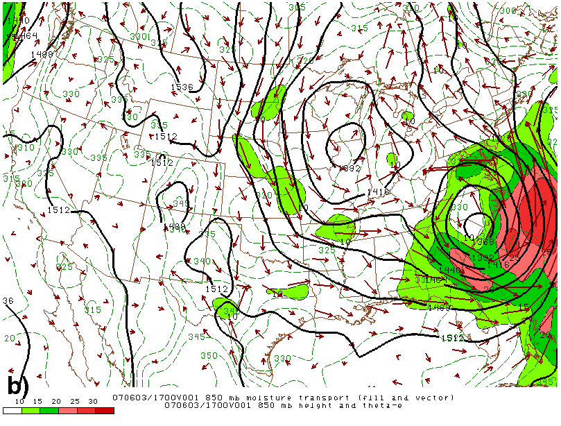
From Storm Prediction Center (SPC) archives, 850 mb moisture transport is shown using short-term RUC model analyses. The red vectors depict the orientation of the moisture advection, while maxima in magnitude are color filled. The black lines are 850 mb height contours, while the dashed green lines are contoured equivalent potential temperatures. The times of these analyses (2100 UTC, 2 June, (a); and 1700, 3 June, (b)) were near the times of scattered convective development across the Ohio Valley and Northeastern U.S. Note how the moisture transport vectors intersect the vicinity of Barry, then move northward around the ridge axis, eventually pointing towards Ohio, Pennsylvania, New York, and New England.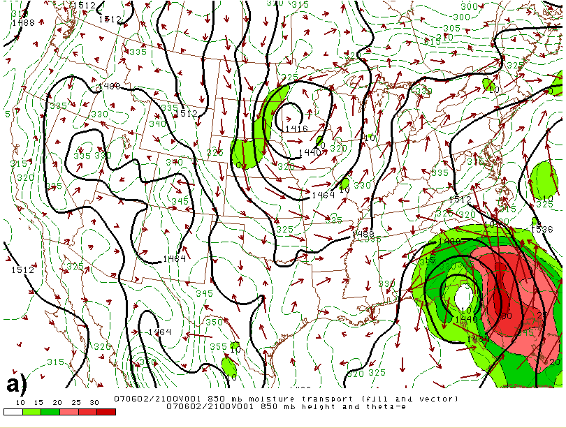
Slide 24
|
|
|||
| National Weather Service Binghamton Weather Forecast Office 32 Dawes Drive Johnson City, NY 13790 (607) 729-1597 Page last modified: June 26, 2007. |
|||